
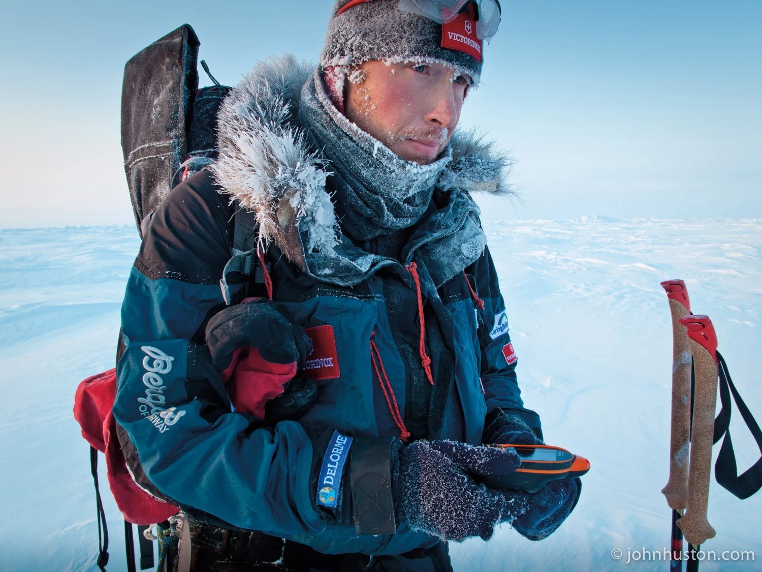

Tyler gets the bearing from the DeLorme PN-40 GPS.
by Tyler Fish
Hello, this is the update for March 16th. It is day 15 of the expedition.
There are probably many of you out there who are wondering how we navigate our way through the Arctic Ocean, across the Arctic Ocean. Navigation is basically using something you trust to keep you heading the right direction. For example, kids hold adults' hands to keep them going the right way. We use handrails on stairways and in dark corridors; we use signs or landmarks, but we have none of these things here on the Arctic Ocean. In fact, any landmarks that we had left us. Two days ago the mountains of Ellesmere Island disappeared and we'll not be seeing them again. And the landmarks that we do have here on the ocean can be very deceiving. John and I today thought we were heading towards something that was 40 feet or higher, kind of a mountain-looking thing, and we started heading towards it and before we knew it we were at the top of it and were very surprised and disappointed to find it was really, really small.
So we don't have landmarks in that way, so what do we use to trust? How do we navigate? We use the sun for one. We know that at 12:15, the sun is directly south of us and our shadows point directly north. We also know that the sun moves 15 degrees every hour, so we can calculate, well, if the sun is over here, it must mean this is where north is. There is a little more to it than that, but that is the gist of it. The disadvantage of that is that if it is cloudy, you don't know where the sun is. There is also the wind; if you know where the wind is coming from you can adjust your direction based on that. The disadvantage is the wind can change or maybe there is no wind.
Then there is the compass. The compass is very trusty. You can use it to find points in the distance to then head to. You do, however, need to know the difference between the magnetic north where the compass is pointing and true north, that is, towards the North Pole. And right now that difference is 77 degrees to the west; in other words, the compass points 77 degrees west of actual north. The disadvantage of that is it is nice to have visibility to use the compass. If you don't have that, it can still work, but it is a little harder.
In the end at the end of the day when we get in our tent and I reach in my pocket, I take out our trusty GPS. We use the DeLorme PN-40. This little device is the only way we can actually know our exact location, our latitude and our longitude. It also helps us figure out how far we have traveled that day, how much we have traveled in total for the expedition, and how far is left to the North Pole. This particular model also tells us the sunrise, when the moon is in the sky. And in the future, we will use this device a lot more than just at the end or at the beginning of every day. We may use it to calculate how much we are drifting on ice that is moving with currents and wind. So eventually this little PN40 will be the only way that we will actually find the Pole itself.
Daily Expedition Data
Date: March 16, 2009
Location: N83° 50.895' W074 13.882'
Time Traveled: 8 hours 30 minutes
Distance Traveled: 4.8 nautical miles
371 nautical miles to North Pole